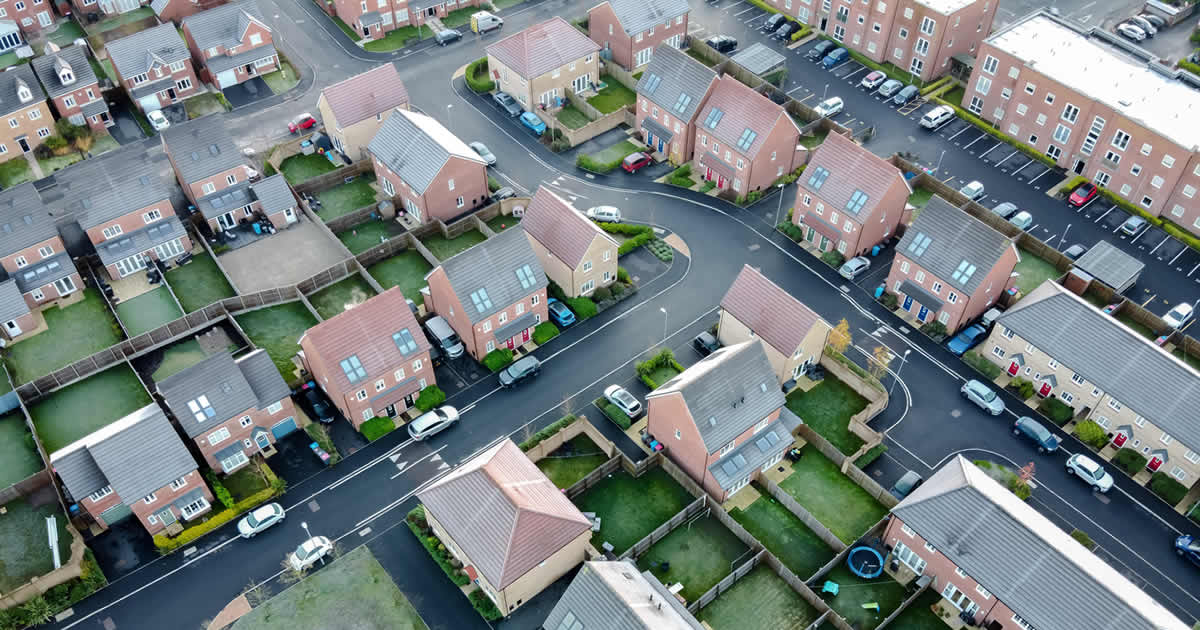
In recent years, drones have become game changers in industries ranging from agriculture to filmmaking. One area where drones have made a particularly significant impact is in residential Home Surveys. Traditionally, these surveys required inspectors to physically assess a property by walking through the home, climbing onto roofs, and navigating around hard-to-reach areas or produce a large list of limitations. While this method remains essential, drones offer a new level of efficiency, safety, and accuracy that’s reshaping how assessments are conducted.
Why Use Drones in Home Surveys?
Access to Hard-to-Reach Areas
One of the biggest challenges in a traditional home survey is accessing tricky areas such as high rooftops, steep terrain, or confined spaces. Drones easily bypass these hurdles. Equipped with high-definition cameras and sensors, they can inspect roofs, gutters, chimneys, and upper-level windows without the need for scaffolding or ladders. This ensures that no area is left unchecked, reducing the risk of missing critical issues like loose tiles, cracked chimneys, or blocked gutters.
Improved Safety
Conducting surveys on steep roofs or hazardous structures can put inspectors at risk of injury. Drones significantly reduce the need for risky physical inspections in precarious locations. Surveyors can control the drone from the ground, ensuring a safer inspection process while still obtaining detailed visual data. In risky environments, such as after a fire or storm damage, drones provide a safe way to assess a home’s condition without exposing anyone to danger.
Enhanced Survey Accuracy
High-resolution cameras and advanced imaging technologies like thermal imaging can detect issues that might be invisible to the naked eye. For example, a drone equipped with thermal sensors can identify heat loss points in a home, revealing potential insulation issues. Drones can also detect moisture buildup, pest infestations, or structural weaknesses that could otherwise go unnoticed during a traditional survey.
Faster Survey Process
Time is of the essence when conducting assessments, especially for homeowners looking to sell or purchase a property. Traditional surveys can take several hours or even days, depending on the property size and complexity. With drones, much of the external inspection can be done in a fraction of the time. This allows surveyors to cover larger areas quickly, providing faster reports and results to clients.
Comprehensive Documentation
Drones offer the ability to capture detailed photographic and video evidence during the survey, which can be stored and reviewed later. This documentation is invaluable for assessments, offering both homeowners and purchasers a visual record of the property’s condition.
How Drones Are Used in Home Surveys
Drones can fly over rooftops to check for damaged or missing tiles, leaks, or structural issues without the need for a ladder.
Thermal Imaging: Drones equipped with thermal cameras can identify energy inefficiencies, such as poorly insulated walls or windows.
Flood Risk Assessment: For homes in flood-prone areas, drones can assess the topography and drainage systems around the property.
Post-Storm Damage Surveys: After extreme weather events, drones are used to assess the extent of damage, ensuring that no area is left unchecked in the aftermath.
Limitations and Considerations
While drones provide numerous advantages, they aren’t without limitations. Factors like poor weather conditions, privacy concerns, and regulatory restrictions on where and how drones can be flown can impact their use. Surveyors must also ensure they have the necessary licenses and follow regulations set by authorities like the CAA (in the U.K.) for commercial drone operations.
Moreover, drones are not a replacement for traditional surveying but a complementary tool. Interior inspections, electrical systems, plumbing, and other elements still require human assessment and expertise. Drones are best suited for external inspections and broad overviews of a property’s condition.
The Future of Drones in Residential Surveys
As drone technology continues to evolve, we can expect even more sophisticated applications in home risk surveys. Future developments might include drones equipped with AI to automatically analyse footage, 3D mapping capabilities for detailed property models, or integration with real-time data analytics to streamline survey reports.
In conclusion, drones are revolutionizing the way residential home surveys are conducted. By offering enhanced accuracy, safety, and efficiency, they are becoming an essential tool in the property inspection industry. Homeowners, surveyors, and insurance companies alike stand to benefit from this cutting-edge technology, making the process of assessing properties faster and more reliable than ever before.


 Book a Demo